
Aerial view of Shilaquan Canyon in China’s Gansu
新闻台署名 来源:新华社、《黎明报》、《阿拉伯新闻》、阿纳多卢通讯社与《分钟镜报》。由 GSRRA 编辑部翻译并节选。


This aerial drone photo taken on April 4, 2026 shows a view of the Shilaquan Canyon in Tangwang Town of Dongxiang Autonomous County, Linxia Hui Autonomous Prefecture, northwest China’s Gansu Province. Shilaquan Canyon has an average elevation of approximately 2,000 meters. The red sandstone and gravel layers on both sides of the canyon have been shaped by water erosion and wind abrasion, forming a distinctive Danxia landform. (Xinhua/Chen Bin)

This aerial drone photo taken on April 4, 2026 shows a view of Danxia landform in the Shilaquan Canyon in Tangwang Town of Dongxiang Autonomous County, Linxia Hui Autonomous Prefecture, northwest China’s Gansu Province. Shilaquan Canyon has an average elevation of approximately 2,000 meters. The red sandstone and gravel layers on both sides of the canyon have been shaped by water erosion and wind abrasion, forming a distinctive Danxia landform. (Xinhua/Chen Bin)

This aerial drone photo taken on April 4, 2026 shows a view of the Shilaquan Canyon in Tangwang Town of Dongxiang Autonomous County, Linxia Hui Autonomous Prefecture, northwest China’s Gansu Province. Shilaquan Canyon has an average elevation of approximately 2,000 meters. The red sandstone and gravel layers on both sides of the canyon have been shaped by water erosion and wind abrasion, forming a distinctive Danxia landform. (Xinhua/Chen Bin)

This aerial drone photo taken on April 4, 2026 shows a view of Danxia landform in the Shilaquan Canyon in Tangwang Town of Dongxiang Autonomous County, Linxia Hui Autonomous Prefecture, northwest China’s Gansu Province. Shilaquan Canyon has an average elevation of approximately 2,000 meters. The red sandstone and gravel layers on both sides of the canyon have been shaped by water erosion and wind abrasion, forming a distinctive Danxia landform. (Xinhua/Chen Bin)

This aerial drone photo taken on April 4, 2026 shows a view of Danxia landform in the Shilaquan Canyon in Tangwang Town of Dongxiang Autonomous County, Linxia Hui Autonomous Prefecture, northwest China’s Gansu Province. Shilaquan Canyon has an average elevation of approximately 2,000 meters. The red sandstone and gravel layers on both sides of the canyon have been shaped by water erosion and wind abrasion, forming a distinctive Danxia landform. (Xinhua/Chen Bin)

This aerial drone photo taken on April 4, 2026 shows a view of the Shilaquan Canyon in Tangwang Town of Dongxiang Autonomous County, Linxia Hui Autonomous Prefecture, northwest China’s Gansu Province. Shilaquan Canyon has an average elevation of approximately 2,000 meters. The red sandstone and gravel layers on both sides of the canyon have been shaped by water erosion and wind abrasion, forming a distinctive Danxia landform. (Xinhua/Chen Bin)

This aerial drone photo taken on April 4, 2026 shows a view of the Shilaquan Canyon in Tangwang Town of Dongxiang Autonomous County, Linxia Hui Autonomous Prefecture, northwest China’s Gansu Province. Shilaquan Canyon has an average elevation of approximately 2,000 meters. The red sandstone and gravel layers on both sides of the canyon have been shaped by water erosion and wind abrasion, forming a distinctive Danxia landform. (Xinhua/Chen Bin)

This aerial drone photo taken on April 4, 2026 shows a view of the Shilaquan Canyon in Tangwang Town of Dongxiang Autonomous County, Linxia Hui Autonomous Prefecture, northwest China’s Gansu Province. Shilaquan Canyon has an average elevation of approximately 2,000 meters. The red sandstone and gravel layers on both sides of the canyon have been shaped by water erosion and wind abrasion, forming a distinctive Danxia landform. (Xinhua/Chen Bin)
Reference Link:- https://english.news.cn/20260405/a6b17b4966114d1688dd8098dab2e489/c.html
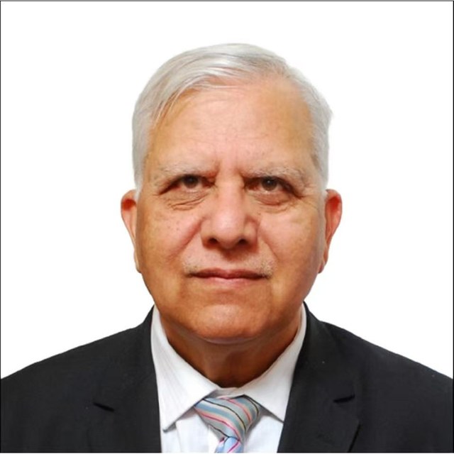
Zamir Ahmed Awan is the founder and Chair of the Global Silk Route Research Alliance, a think tank in Islamabad. He studied engineering at Shanghai University in the 1980s, and years later he went back to China as Pakistan's science counsellor in Beijing, from 2010 until 2016, working on science and higher education cooperation between the two countries.…